Improvement of GPS ambiguity resolution using prior height information.PartⅠ:The method by using height validation
来源期刊:中南大学学报(英文版)2002年第3期
论文作者:朱建军 Rock Santerre
文章页码:186 - 190
Key words:ambiguity resolution; height validation; robustness; OTF techniques
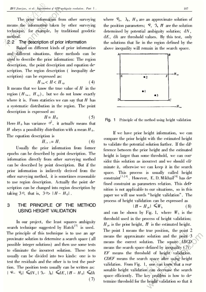
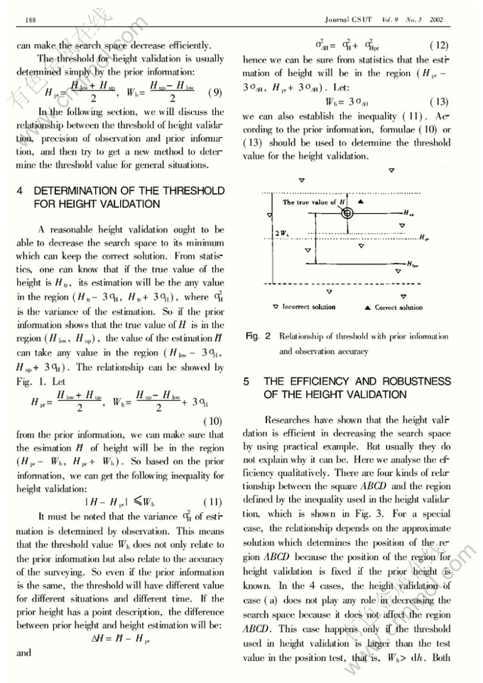
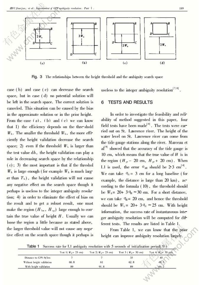
Abstract: It is an attractive method to combine GPS observations with the information from other surveying system to improve the ambiguity resolution. This research is conducted to investigate how to obtain the prior height information in bathymetric surveying by GPS positioning and howto use the prior height information and to obtain a robust result. The authors deal with the collection and the description of the prior height and the method using height validation to improve the ambiguity resolution. The principle of the method, the relationships between the height threshold and the ambiguity search space are presented. A method to determine the threshold for the height validation is suggested. The field tests are carried out to show the feasibility of the proposed methods.


